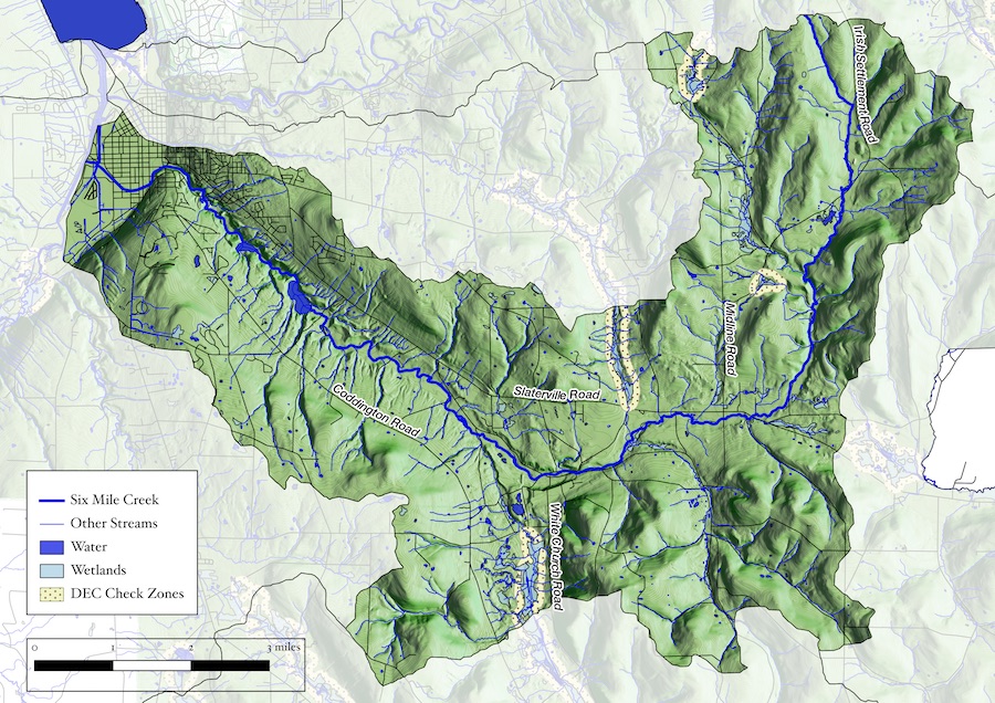
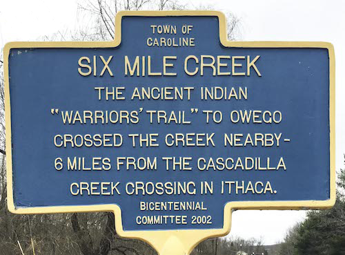
Six Mile Creek, called Teegastoweas Creek in the earliest map of Ithaca1, winds its way for twenty miles from its headwaters in the Town of Dryden, through the forests and fields of the Town of Caroline, the hamlets of Slaterville Springs and Brooktondale, and on down to its outlet on Cayuga Lake. It has long served as the source of the City of Ithaca’s drinking water, and therefore remains a vital resource for Tompkins County. Less widely known is the rich and varied history of life along the banks of the creek—above all, how the creek has been enjoyed for pleasure and recreation and harnessed for industry and profit. We hope our interactive exhibit provides an entry to this history through the sights and sounds of creek in the past and the present. And we invite you, in the words of G. E. Smiley, to
sit on the banks of that old Six-mile brooklet
And allow its cool water before you to rush.2
Susan C. Larkin, Kim Haines-Eitzen, Tim Larkin
- Made by Moses DeWitt in 1790.
- G. E. Smiley, Caroline Hills, in Kone et. al. A History of the Town of Caroline, p. 12.
Instructions
- Tap the speaker to stop or start the sound.
- Touch the green buttons at the top to go to other pages
- Go to our Site Map.
- Questions or suggestions? Contact us at info@toursixmilecreek.org